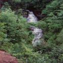
Pictured Rocks National Lakeshore
| Website: | Pictured Rocks National Lakeshore |
| Owner: | National Park Service |
| Size: | 73,236 Acres |
| Avg Temp: | (Feb) 4 F° → 26 F°  |
| Attributes: | |
Facilities |
| Boat Launches |
| Campgrounds |
| Entrance |
| Lighthouse |
| Parking Lots |
| Restroom |
| Trails |
| Water Bodies |
| Waterfalls |
Neighboring Features |
| Nature Area |
| Trails |
| Water Body |
| Water Courses |


